
You are here
Best Practices
As part of the research being conducted on this project, we are forming "Best Practice" documents that suggest methods for efficient use of available survey resources in a storm response event.

This document describes the methods that we use internally to manage imagery that we construct for data products, and how we make them available for distribution through our ArcGIS server.
This document describes the methods that we use internally to process Kongsberg GeoAcoustics GeoSwath Plus bathymetry using CARIS HIPS tools.

This detailed procedure document describes how to use the USGS Digital Shoreline Analysis System software to generate shoreline change information.
This procedure document describes LIDAR processing methods implemented through ArcGIS methods.

This procedure document describes LIDAR processing methods implemented through LAStools, ArcGIS, Fledermaus, VDatum, LP360 and Bathy DataBASE.

This procedure document describes a method to determine changes in the morphology of a given area using only satellite-derived bathymetric data.
This document describes methods for processing EdgeTech Phase Measuring Bathymetric Sonar system data using CARIS HIPS 8.1 and 9.0 in order to efficiently move the data through a processing pipeline, and generate acceptable bathymetry at the output.
The presence and density of submerged aquatic vegetation is an important indicator of possible habitat, and assessment of this feature of marine areas in the aftermath of a storm can be important in understanding the impacts of the storm on habitat. This document describes a method for processing satellite imagery to estimate presence of submerged aquatic vegetation, and how to compare it to a groundtruth in order to estimate accuracy.
Classifying the presence and types of submerged aquatic vegetation is an important step in tracking changes over time, or after a storm event. This document describes a method for analysis of lidar waveform features and RGB imagery using object-based image analysis to generate thematic maps of submerged aquatic vegetation within a geographic area.
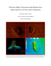
In the wake of a major storm event, it is important to quickly survey navigble waters to assess the impacts of the storm. This document describes the 'lessons learned' from examining datasets collected after Super Storm Sandy with the goals of detecting objects and identifying the smallest observable changes in seafloor features.
The extreme variability of marine debris makes automatic detection and identification of targets complex. This document reports on a method developed that uses prior knowledge, multiple classifiers, and probabilistic data fusion to approach this problem, which results in a hot-spot map to predicted debris locations given the data observed.


