
You are here
Shoreline Change
We are developing methods for rapid estimation of shorelines from remote sensing data in the Super Storm Sandy-affected areas, particularly around the Barnegat Bay, NJ and Long Beach Island, NJ. We are focusing specifically on use of lidar data for this, since it can be rapidly collected in a response situation and quickly turned around to provide rapid feedback on the current situation in the aftermath of a storm event.
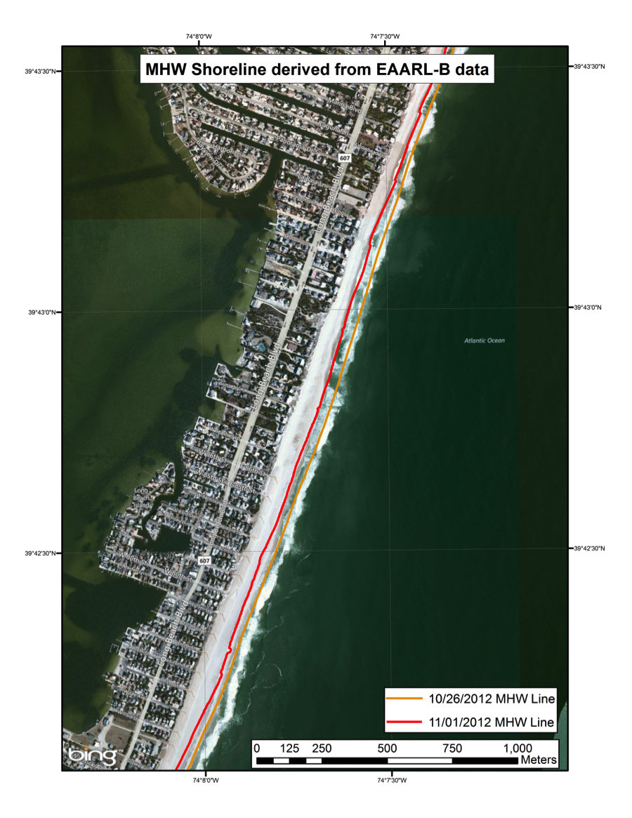
Estimate of shoreline change in Barnegat Bay, NJ due to Super Storm Sandy [1.2MB].
This data, derived from U.S. Geological Survey LIDAR data observed using the EAARL-B (Experimental Advanced Airborne Research Lidar), illustrates the extent of Mean High Water [MHW] shoreline change due to the effects of Super Storm Sandy. The shoreline has moved consistently onshore indicating overall removal of material from the beach. The raw data was read through LAStools, converted to the appropriate datum using VDATUM, gridded using QPS Fledermaus, and then processed with ArcGIS to generate the shorelines. Similar processing is used to develop the deposition/erosion data products. This process for generating shoreline is unconventional, but can be implemented rapidly with standard tools in a response situation.


